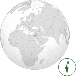
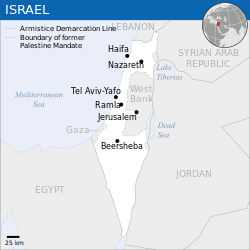
State of Israel |
|---|
|
Anthem: Hatikvah
(English: "The Hope") |
 |
 |
| Capital and largest city | Jerusalem
(limited recognition)[fn 1]
31°47′N35°13′E / 31.783°N 35.217°E / 31.783; 35.217 |
|---|
| Official languages | Hebrew |
|---|
| Recognized languages | Arabic[fn 2] |
|---|
| Ethnic groups (2019) | |
|---|
| Religion (2019) | |
|---|
| Demonym(s) | Israeli |
|---|
| Government | Unitaryparliamentaryconstitutionalrepublic |
|---|
|
| Isaac Herzog |
|---|
| Naftali Bennett |
|---|
| Mickey Levy |
|---|
| Esther Hayut |
|---|
|
| Legislature | Knesset |
|---|
|
|
| 14 May 1948 |
|---|
| 11 May 1949 |
|---|
| 1958–2018 |
|---|
|
|
• Total | 20,770–22,072 km2 (8,019–8,522 sq mi)[a] (150th) |
|---|
• Water (%) | 2.71 (as of 2015)[15] |
|---|
|
• 2021 estimate | 9,398,690[16][fn 3] (99th) |
|---|
• 2008 census | 7,412,200[17][fn 3] |
|---|
• Density | 426/km2 (1,103.3/sq mi) (35th) |
|---|
| GDP (PPP) | 2020[20] estimate |
|---|
• Total |  $372.314 billion[fn 3] (51st) $372.314 billion[fn 3] (51st) |
|---|
• Per capita |  $40,336[fn 3] (34th) $40,336[fn 3] (34th) |
|---|
| GDP (nominal) | 2020[20] estimate |
|---|
• Total |  $410.501 billion[fn 3] (31st) $410.501 billion[fn 3] (31st) |
|---|
• Per capita |  $44,474[fn 3] (19th) $44,474[fn 3] (19th) |
|---|
| Gini (2018) | 34.8[fn 3][21]
medium · 48th |
|---|
| HDI (2019) |  0.919[fn 3][22] 0.919[fn 3][22]
very high · 19th |
|---|
| Currency | New shekel (₪) (ILS) |
|---|
| Time zone | UTC+2 (IST) |
|---|
| UTC+3 (IDT) |
|---|
| Date format | - יי-חח-שששש (AM)
- dd-mm-yyyy (CE)
|
|---|
| Driving side | right |
|---|
| Calling code | +972 |
|---|
| ISO 3166 code | IL |
|---|
| Internet TLD | .il |
|---|
|

